Malham Circular
This walk takes you around some of Malham’s gems, all in one circular family friendly walk!
You’ll spot the trio of Malham’s natural wonders, Janet’s Foss, Gordale Scar and Malham Cove too!
So in technical terms… I guess you’re meeting the true celebrities of the Yorkshire Dales National Park (because it’s the place EVERYBODY talks about!)
Are you looking for the classic Malham circular walk?
Well this walk is a family friendly walk around Malham, all in one lovely circular.
We’re talking Janet’s Foss, Gordale Scar and Malham Cove all in one walk! So basically think fairytale waterfalls, GIGANTIC cascades tumbling down dramatic rock amidst towering limestone cliffs that are hundreds of metres high, expanses of limestone pavement SO epic that they were deemed an ideal backdrop for Hollywood movies and a humungous rock face, once home to an absolutely gigantic waterfall (one that would have once rivalled Niagra) now, a climber’s paradise (although a waterfall did once make a reappearance during Storm Desmond, making it temporarily the highest waterfall in England!)
You can see why so many people flock to Malham right? And it’s true, during peak seasons, Malham will be extraordinarily busy and you will have hundreds and thousands of people for company. So we thoroughly recommend heading there off peak, or either early or late in the day!
We have also got bite-sized versions of these walks for younger explorers too! You can check out the separate walks to Janet’s Foss and Gordale Scar and Malham Cove if you’d prefer something shorter.

Walk Details for the Malham Circular
Distance: Just over 5 miles
Terrain: Varied. Mostly well maintained paths and all well signposted due to the popularity of the route. There is some ascent (around 300m). Be aware that the limestone of the pavement at the top of Malham Cove can be extremely slippery in wet, damp or icy conditions. (And I mean that… having been dragged across there in clag by two dogs and barely surviving unscathed!!)
Parking: In the Malham Yorkshire Dales Visitor Centre Car Park. There is often overflow parking available at peak times and there is some limited roadside parking before entering the village. Please do park responsibly and with regard to the residents of Malham. It is busy place, but can you imagine living there?! So do not block access to properties or fields. Nor park to narrow the roads, thereby blocking access to emergency vehicles who need access at all times (all issues in the past). If you are unable to park, try one of our other walks in the Malham area with alternative start points, perhaps up at the tarn which tends to be on the quieter side. Stainforth is within easy access from here too where you can walk to Catrigg Force waterfall or the Hoffman Kiln.
Public Transport: There are buses that run to Malham. Check out the bus timetable on the Dales Bus Website.
Dog friendly? Yes, dogs to be kept under close control
Location: Malhamdale, Yorkshire Dales National Park
What 3 Words: roughness.sung.fortnight - for Malham Car Park
Toilets/ Baby Change: Yes, at Malham Visitor Centre
Nearest Cafe/ Amenities: We recommend The Old Barn Cafe or the Lister Arms.

Walking along the flagged path at the start of the walk.

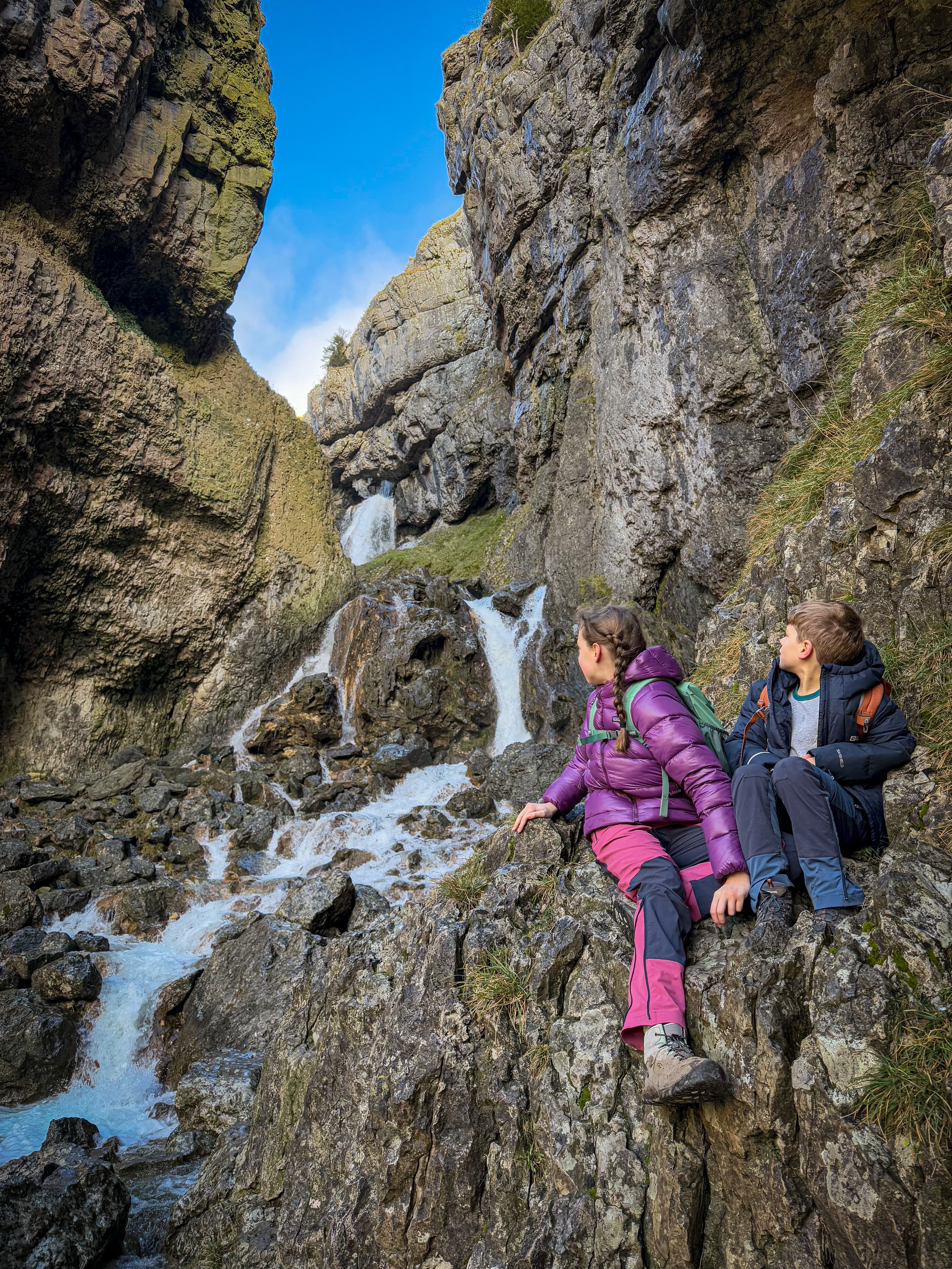
Janet’s Foss waterfall

The approach to Gordale Scar

Standing at the foot of Malham Cove
How to walk the Malham Circular
Directions to be used in conjunction with a map.
Beginning from the Malham Visitor Centre Car Park, exit the car park and turn left along the road heading into the village (you’ll pass the Old Barn Cafe on your left - great for a coffee, cake or a light bite in case you need to fuel up before you go!) Just before you get to the Malham Smithy on the opposite side of the road, cross over and head to the little stone footbridge over the beck, signposted Janet’s Foss and Gordale Scar.
Once across the bridge turn right, with the beck now to your right. You are on a well surfaced wide path, which is at times paved (as pictured). Follow the path through a gap in the wall and then through a double gate. Here, bear left, keeping the dry stone wall to your left and walk towards the farm buildings where there is a further gate in the wall.
Go through the gate and continue along the wide path which passes through another gate, turning into a flagged path and following the edge of the beck. Continue to follow this path, there are no offshoots here, you simply need to follow it until you reach the National Trust sign for Janet’s Foss, which takes you into the woodland.
After this gate the path continues to follow the beck (which is still on your right) through the woodland, where it begins to be more undulating. You will soon hear Janet’s Foss before you see her! Take a moment to appreciate her magic (for she is the home of the Fairy Queen of course!) it’s likely you’ll encounter wild swimmers here, as it is a bit of a haven! (Yes, I include myself, as I’ve swum in Janet’s Foss all year round! I can confirm the quietest I’ve seen her has been in the run up to a storm in some pretty shocking weather!) So be prepared to share her! She’s a popular waterfall! (leave no trace - Janet is super popular, so if you see any rubbish, please do pick it up and take it with you even if it’s not yours!)
After Janet, head along the path next to the wall (with the waterfall on your right and head up and out of the woodland. Here the path is rocky and a little bit scrambly, but nothing that is too taxing! You will get to a gate leading onto the road to Gordale Bridge. Head out of that and turn right (signposted Gordale Scar).
Follow the road for a little while (you will regularly see the food van at Gordale Bridge, which sells hot drinks and tasty treats - excellent sausage rolls!) continue past the Gordale Bridge pull in, and head straight on. The road will begin to bend round to the right, and here there is a gate in the wall opposite, next to the information board for Gordale Scar. Head through the gate and onto the wide track ahead. This track will take you all the way to Gordale Scar.
Once you have soaked in the absolute GLORY of Gordale (pictured at the head of the page), you need to double back on yourself and head back to Gordale Bridge. If the food van isn’t there, you can identify it as it is quite literally the bridge over the Gordale Beck. There you will see a gate in the wall on your right, signposted Malham Cove, 1 mile. Follow that signpost!
What begins as a gravelly path, turns into a grassy one and it heads steeply uphill at first, before levelling out a bit (be aware this bit can get slippery when wet due to mud) You will head through a gate, then through another field, before reaching some stone steps up to a further gate. Here follow the signpost pointing left to Malham Cove.
You will continue to follow the wall on your left until the path reaches the road (Malham Rakes - here, if you need to, you can cut the walk short - head to our Janet’s Foss walk for further instructions on that return route)
Cross the road to a ladder stile over the dry stone wall ahead and cross it (there is also a gate) and continue to follow the path straight on. There is a footpath sign pointing in the direction of Malham Cove 1/4 mile. Follow the path in the direction of that signpost. At this point in good visibility, you will be able to see the top of the cove and the limestone pavement emerging ahead.
Continue in the direction of the cove, as the path descends slightly to a dry stone wall with a gate in it and a further signpost. Head in the direction of the signpost and up onto the limestone pavement (pictured in walk details section). In anything other than bone dry conditions, the pavement can be slippery and there are lots of deep grykes (fissures in the rock) to hop over. Which can be fun, but also…. quite interesting! If you’d prefer to avoid it we’ve found the easiest terrain underfoot is slightly higher up. Whatever you choose, you need to head directly straight on towards the far end of the cove, keeping the edge of the cove well away on your left. Here is where they filmed one of the locations for the final Harry Potter film.
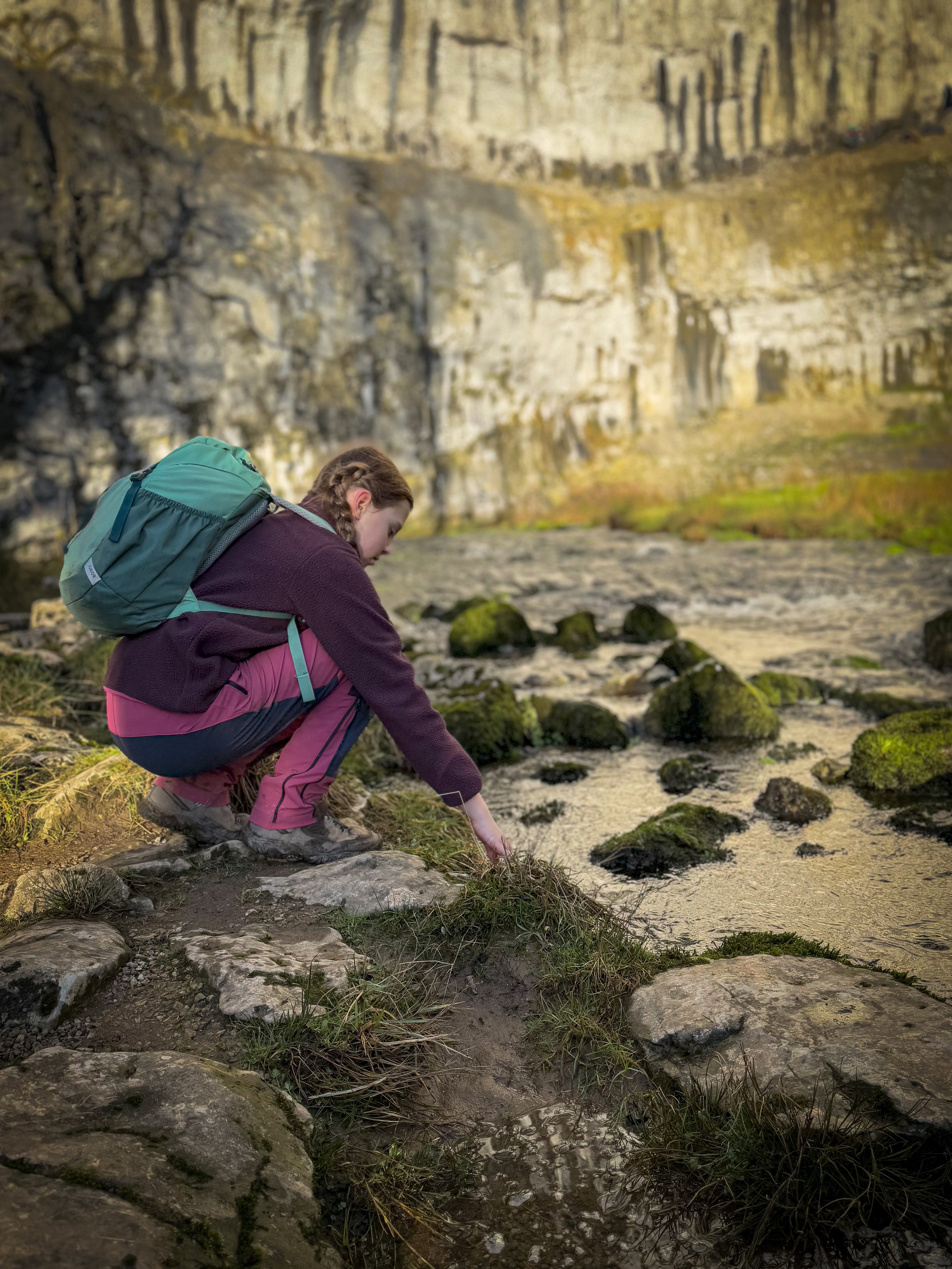
At the far end, you will spot an information board about the limestone pavement and directly ahead, you will spot an opening in the dry stone wall, leading to a gate. Head through the gate and down the steps beyond it, which take you to the base of the cove. Towards the bottom, there is a further gate and then beyond you can bear left to continue right to the bottom of the cove, where you can observe climbers, and the beck emerging from the cave systems below the rock.
Turn back on yourself and continue along the path following the beck which will be on your left. You can either continue to follow this path all the way back to the road and then to the village, or you can follow our route, which avoids the road walk (and we think is much prettier!)
A short distance from the base of the cove, you will see a stone bridge made up of several flat flags on your left, crossing the beck to a gate ahead. Cross the beck and head through the gate. Ahead you will see a steep bank. The path heads diagonally right and upwards towards the rocky bank meeting the top end of the dry stone wall on your right.
From there continue straight on, passing the ruins of Bombey’s Barn on your left, and then through a gate into a narrow fenced path. The path is very clearly marked and varies between open field, walled path and further fenced paths all the way back to Malham. You will exit via a gate onto an access road, which takes you straight back to the village.
Last walked January 2025.
What’s cool for kids on the Malham Circular?
☕ Grab a bite from The Old Barn Cafe. They sell excellent home made food including cakes and you can also paint pottery there too!
✨ There is SO much going on, on this walk that’s COOL. Ok. Cool for somebody who loves a bit of folklore and geology… as I do! Malham is pretty special. That’s why it’s so popular! With all the epic grandeur of the limestone landscape, you will see why! But actually WHY is it so epic right here? Well, to find out you need to cast your mind back a few hundred million years ago (not long…) to when the North was covered with a warm tropical sea (back then, we were down near the equator). During that period, all the sea creatures that died, layered up at the bottom of the sea and created the limestone we see today (which is why you get SO many fossils in the Yorkshire Dales). Then fast forward a few hundred million years to the ice ages, all of which formed the geography we see today in Malham. Gordale Scar is a possible combination of a few collapsed caves and ice grinding deep down to create the 100m high sides of the gorge. The cove was formed by a HUGE waterfall, which eroded the centre of the cove, creating the curved shape it is now and then enter rain. Limestone is soluble and the carbon dioxide in rain makes it ever so slightly acidic. So the landscape we see today is still being changed by the rain! Cool huh?
👻 Janet’s Foss is the home of Janet (or Jennet) the Queen of the Fairies. Look carefully behind the waterfall (it’s more visible when there’s less water coming over the falls) and you’ll see a cave, which is her home! You can read more about the legend that is Janet over on our Tales of the Dales blog!
💦 Plenty of people have a swim or a splash in Janet’s Foss, but if you do make sure you leave no trace and take any rubbish you find home with you! For Summer swim safety advice check out the RLSS website!
🌳 why not try one of our walking games? Or you can download a free scavenger sheet!
Helpful Information!
For more helpful information head to our safety tips and advice page.
⭐ We hope you enjoy our walks, but please exercise common sense as routes can change with the weather conditions and seasons! These walks are intended as a guide only and are undertaken at your own risk. The routes have been walked by our own two feet, but you know your own limits. If in doubt, turn back. Always take a back-up map, don’t rely on GPS or your phone alone, wear appropriate clothing for the weather and take adequate snacks and refreshments with you (although as a parent, I know you already know that bit!)
⭐ Leave no trace! Take nothing away and leave nothing behind, take all rubbish home with you.
⭐ If you choose to paddle, be aware of bio security. Always wear clean dry water shoes (if worn) to avoid cross contamination of species between watercourses, this is a particular issue in the Yorkshire Dales, to help protect the white clawed crayfish.
⭐ If you decide to paddle, be aware that wild water can be dangerous, and water levels will vary season to season. Always supervise children around water. Check out the safety information on the Royal Life Saving Society website.


Want to grab the route?
Head to the Ordnance Survey Navigation App where you can download the route!
(Always carry a back up map and know how to use it)
Image is Copyright of Ordnance Survey
Follow us for up to date Outdoors Adventures!
We live and BREATHE the Yorkshire Dales outdoors life!
BEEN INSPIRED? Tag us @reluctantexplorers
Come follow our journey over on Instagram, Facebook, Twitter and TikTok, where you’ll find up to date walk info, breaking news on Yorkshire Events, new Yorkshire Dales wild swim spots, climbing, caves and more!


Follow us on Social Media for all the up to date info: @thereluctantexplorers
Scroll using the arrows for all our Family Friendly Walks
-
![Swimming in Janet's Foss Yorkshire Dales]()
Waterfall Walks
-
![Malham cove walk for kids]()
Pushchair Friendly
-
![Pinhaw Beacon trig point walk near Skipton]()
Peak Bagging Walks
-
![The Park at Greenhow Nidderdale]()
Walks with Play Parks
-
![Gordale Scar in Malham Yorkshire Dales]()
Organised by Location
-
![Walking in the woodland in Wensleydale]()
Woodland Walks
-
![Playing on the shore of Embsay Reservoir Yorkshire Dales]()
Reservoir Walks
-
![The ruins of Bolton Abbey]()
Bolton Abbey Estate Walks
-
![Leaping over the stile at Almscliffe Crag]()
Walks Under 2 Miles
-
![Child walking into a pub in Appletreewick]()
Walks with Pubs and Cafes